Took another look at the radar. Guess I'm dragging the hose around again this weekend and next week.


spadilly said:
It really the way I expected to spend the afternoon, but not complaining…

spadilly said:
It really the way I expected to spend the afternoon, but not complaining…


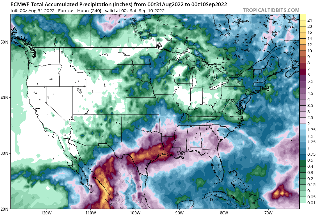
https://spacecityweather.com/rain-chances-shift-toward-coast-as-houston-area-faces-a-wet-wednesday/Quote:
Expect to see some social media noise during the next couple of days because the operational run of the GFS model, for the last few runs, has been bringing a fairly strong tropical system to the northern Gulf of Mexico coast late next week. However there are a very, very broad range of outcomes here, and the scenario with the most support right now would see a weaker tropical system that tracks more westward, into the Yucatan Peninsula and Mexico. So really, anything can happen.
The bottom line is that this is a system for us to watch at this point, and that should come as no surprise as we're in the midst of the peak of the Atlantic hurricane season. For now, as usual, be wary but not worried.
Quote:
Of most concern to us is the blob I've marked "1." Both the European and US GFS models have been highlighting this potential for a couple of days, and I'd say there's a pretty good chance that some sort of tropical system, whether it be a disorganized area of thunderstorms or a tropical storm, will reach the northwestern Caribbean Sea by Wednesday or Thursday of next week. After that, it probably would move into the Gulf of Mexico. It could really go anywhere after that, but the most likely locations would be Mexico, Texas, or Louisiana. The bottom line is that we're looking at the possibility of a tropical system in the Gulf of Mexico as we head into Labor Day weekend.
This is not something you should panic about, by any means. The storm must overcome wind shear and a host of other obstacles. But as we get into late August and early September, we're going to be watching all of these waves closely, because the next month is prime time for Gulf of Mexico hurricanes.

BayAg_14 said:
Latest update from SCW as well as latest GFS run.Quote:
Of most concern to us is the blob I've marked "1." Both the European and US GFS models have been highlighting this potential for a couple of days, and I'd say there's a pretty good chance that some sort of tropical system, whether it be a disorganized area of thunderstorms or a tropical storm, will reach the northwestern Caribbean Sea by Wednesday or Thursday of next week. After that, it probably would move into the Gulf of Mexico. It could really go anywhere after that, but the most likely locations would be Mexico, Texas, or Louisiana. The bottom line is that we're looking at the possibility of a tropical system in the Gulf of Mexico as we head into Labor Day weekend.
This is not something you should panic about, by any means. The storm must overcome wind shear and a host of other obstacles. But as we get into late August and early September, we're going to be watching all of these waves closely, because the next month is prime time for Gulf of Mexico hurricanes.
https://spacecityweather.com/rain-shifts-south-of-metro-houston-today-and-were-watching-the-tropics-ahead-of-labor-day-weekend/

Serotonin said:
I mean, what are the chances of a flood on a holiday weekend?