
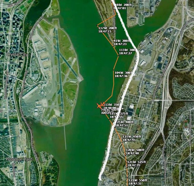
From the map you can see the 200 ft flight limit. Clearly the PAT25 (UH60) was above 200 ft at the time of conflict. Additionally, I believe ATC asked PAT25 for visual of the JIA5342 (CRJ) and asked for them to pass behind (to the east or right) and PAT25 went the opposite direction. PAT25 confirmed they had aircraft in slight (may have been AAL3120 behind JIA5342), requesting visual separation, with ATC approving.bobbranco said:
The helicopters are supposed to follow Route 1 and Route 4 above the eastern shore of the Potomac River. See below for the routes. The flight track of the UH60 shows it deviated from Route 1 by passing over the golf course at Hains Point and ends up almost mid Potomac at the crash location. The glide paths are well established and the UH60 would have clearly been interfering with the glide path when deviating from the established route.
The AAL pilots carry 0% fault. It was the failure of the ATC and the UH60 pilots based on these diagrams.

Agreed that the CRJ pilots shouldn't be a fault. I believe it will primarily be the fault of the UH60 pilots, but ATC should have had better control of the situation.
All that to say, what the heck do I know though...


