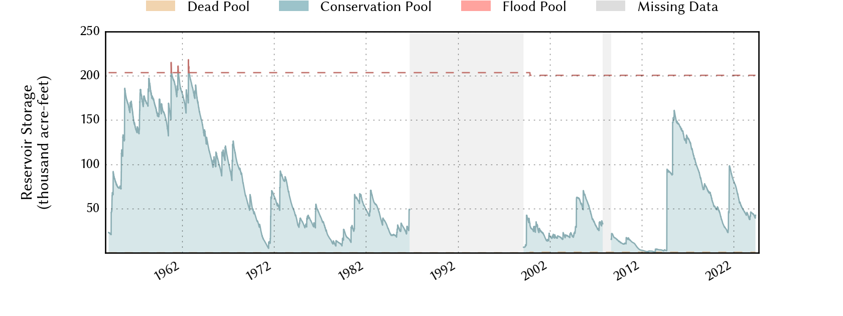
Lake Level Graph
USGS Info
Google Maps
Gone up 35 feet in two days. The little town of Gail (Borden County) has received 18+ inches of rain in the last three days. That would be the normal yearly rainfall.
Lake has gone from essentially dry to 80,000 acre feet of water storage. My handy-dandy calculator tells me that's about 26 Billion gallons of water. From 2.5% full to 26% full in days, and it's still raining.
My mom's family used to have a cabin there when I was a kid. When I was at A&M, I went by on one trip home to see it again. They were grazing cattle in front of the dock where we used to fish and ski. An electric cattle fence was tied to the corner post of our dock.
Amarillo TV said water was going over the spillway, but best I can tell, it's still about 21 feet from full. I wonder if they were referring to Bull Creek. That's a paralell creek that is dammed and has a canal to divert to Thomas.


