Folsom Man

3,447 Views | 21 Replies | Last: 3 yr ago by CanyonAg77
CanyonAg77
How long do you want to ignore this user?
AG
The discoverer of the site where the Folsom Point was found, and the question of how long man has been in the Americas was (somewhat) resolved, was a former slave/black cowboy from Texas.

He knew he found a special site, but died before the excavation and discovery of the Folsom Point.

Good article about him in Texas Monthly

https://www.texasmonthly.com/the-culture/texans-you-should-know-how-a-black-cowboys-discovery-changed-the-field-of-archaeology/

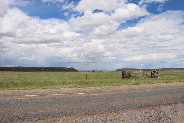
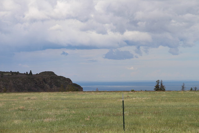
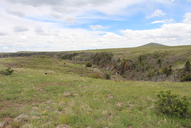
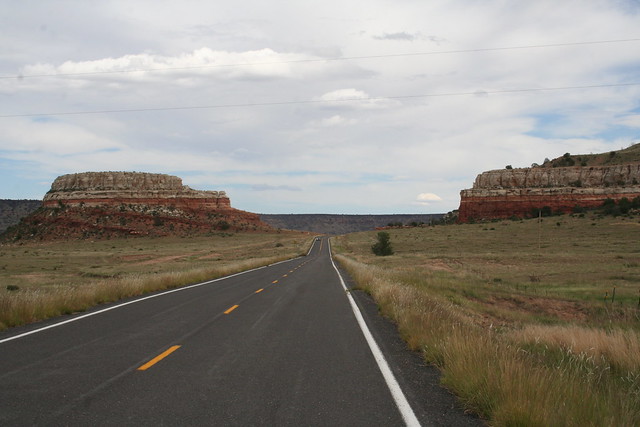
If you ever head from Amarillo into SE Colorado in the summer, take some extra time and go through Folsom. Stunningly beautiful part of New Mexico, especially the drive across Johnson Mesa on NM72. Iff you have lots of time, check out the local museum.

Quote:

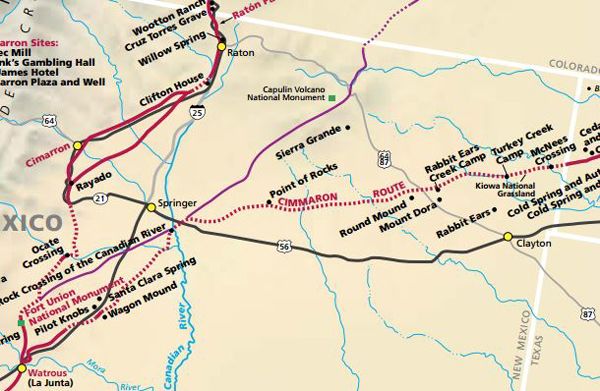
On the evening of August 27, 1908, dark clouds gathered over the Dry Cimarron River along the New MexicoColorado border. Sarah Rooke, the phone operator in Folsom, New Mexico, called as many people as she could to warn them about the impending storm, but it wasn't long before water began pouring from the sky and rushing through the town, wiping away entire buildings in its path. More than a dozen lives, including Rooke's, were lost in the flash flood that night.

The next day, George McJunkin, a cowboy from Leon County, east of Waco, who worked as the foreman of a ranch near Folsom, took his horse out to survey the damage. As he trotted along the edge of a gully, which he called Wild Horse Arroyo in honor of the horses he broke there, he spotted something unusual sticking out of the soil....
FIDO_Ags
How long do you want to ignore this user?
Just drove NM72 yesterday and it never lets us down! Every trip to Colorado includes a stop at Capulin Volcan and a drive to the top followed by a trip to Raton Via 72. Gorgeous scenery. The Capulin Volcano has some good info on McJunkin.

Tried to go to Folsom museum last summer and yesterday but it's all closed due to Covid. The volcano museum is too. First time I haven't driven to the top in 4 years.

Thanks for posting Canyon!
CanyonAg77
How long do you want to ignore this user?
AG
Didn't know anyone else had been across Johnson Mesa. Beautiful place. Unfortunately, you can't go to Folsom Falls anymore, jerks made too big a mess, and the owners closed it.

Tollgate Canyon and the Dry Cimarron are also interesting drives.
FIDO_Ags
How long do you want to ignore this user?
Didn't know that about the site, too bad. Also didn't know it was called the Johnson Mesa. That little corner of NE New Mexico is really fascinating.

Tried to read up on the TO Ranch too but haven't found out much about it's history.

Will have check those out on another trip!
hillcountryag86
How long do you want to ignore this user?
AG
https://silverspurranches.com/new-mexico/

https://newmexicoranchlife.wordpress.com/2012/07/31/ranching-on-the-to-living-history/

One of my favorite parts of trips to NM is passing the TO. Would love to see that place.
CanyonAg77
How long do you want to ignore this user?
AG
The TO headquarters is at the south base of Johnson Mesa, I suspect they may own a lot of the top. A few photos of mine from the top of Johnson Mesa


From inside the old church on the Mesa


Down the Dry Cimarron to the east of Folsom


FIDO_Ags
How long do you want to ignore this user?
Thanks for the links HillCountry and awesome photos Canyon. Didn't know you could go in the church, though I never tried either.

Stopped by Clayton Lake last summer to check out the dinosaur tracks. It is a pretty large track, part of the Glen Rose formation so similar to tracks at Glen Rose, Tx (Cretaceous) and the ones near Canyon Lake, but Clayton has Acrocanthesaurus (T-Rex cousin) tracks too. Never saw those before.

Will have to check out Dry Cimarron. That looks straight out of an old western movie.
FIDO_Ags
How long do you want to ignore this user?
One addition, stopped by Clayton Lake to watch the sunrise Sunday, but it is currently closed due to Covid too.

Got a neat pic of the sun rising over Rabbit Ear mountain, so was still good. Don't know how to post it though.
CanyonAg77
How long do you want to ignore this user?
AG
FIDO_Ags said:

Stopped by Clayton Lake last summer to check out the dinosaur tracks.


Lots of Santa Fe Trail swales in the area, if you're willing to travel back roads. The Eklund is an interesting place. Last time we were through, it was pretty good food. We've stayed at the hotel before, it's pretty decent for being an old hotel, but the constant train traffic wasn't good.
CanyonAg77
How long do you want to ignore this user?
AG
Also a pretty good dino track site at the Picketwire in Southern Colorado, south of La Junta. A little harder to get to, but neat.

Don't have many pics from there. The weekend we went, it was after a heavy rain in Trinidad, and the tracks were under water.

https://en.wikipedia.org/wiki/Purgatoire_River_track_site

https://www.fs.usda.gov/recarea/psicc/recarea/?recid=77620
FIDO_Ags
How long do you want to ignore this user?
Canyon, what are Sante Fe swales? Are those the little mini canyons around the area?

Will definitely check out Picketwire, May do the auto tour since I bring a Jeep up here. Not sure the family could hike 17 miles. Not sure I can either, but those are Jurassic age tracks and I've never seen any that old.

Will definitely stay at The Eklund next time. Neat history there. Booked last minute reservations at the Super 8 in Clayton...I would've rather listened to trains at The Ecklund and now my wife is mad since I showed her this post. I don't recommend the Super 8 unless you're really tired!
CanyonAg77
How long do you want to ignore this user?
AG
Santa Fe Trail swales.

They're the erosional remnants of the Santa Fe Trail ruts. In this case, the Cimarron cutoff that goes through NE New Mexico. Once you realize what you're looking at, they're easy to find. Erosion has shaped the old ruts into shallow, wide u-shapes. I have some photos, not real sure where they are right now.

An example in the area is McNees crossing

https://www.nps.gov/places/mcnees-crossing.htm


https://www.legendsofamerica.com/nm-cimarronroute/
CanyonAg77
How long do you want to ignore this user?
AG
In this photo, (Google Maps) you see the darker green stripes going from the upper right to the lower left. Those are the swales, and since they're low spots, they collect water and are greener. The trail was not one set of ruts. The wagons would take parallel routes to avoid each other's dust, or take alternate routes around mud holes and such. That's why you get lots of different ruts and swales.


Here's the Google Maps link, so you can scroll around for yourself. Follow the ruts around.

McNees Crossing

CanyonAg77
How long do you want to ignore this user?
AG
Another modern road crossing the Santa Fe Trail

Google Maps
CanyonAg77
How long do you want to ignore this user?
AG
Dinosaur trackway at Picketwire

Google Maps
FIDO_Ags
How long do you want to ignore this user?
Thank for the explanation Canyon. Didn't know those were called swales. I used to check out Oregon Trail swales (I always called them ruts up there), so definitely look at those too. Might try to on the way home.

Reading Hampton Sides book about Kit Carson right now. It spends some time talking about the Sante Fe Trail so I'm interested in seeing some.

Really appreciate the posts!
CanyonAg77
How long do you want to ignore this user?
AG
Quote:

Reading Hampton Sides book about Kit Carson right now
Biggest Indian battle during civil war was in the Texas Panhandle.


https://en.wikipedia.org/wiki/First_Battle_of_Adobe_Walls

Quote:

The Battle of Adobe Walls occurred on November 25, 1864, in the vicinity of Adobe Walls, the ruins of William Bent's abandoned adobe trading post and saloon, located on the northern side of the Canadian River 17 miles (27 km) northeast of present-day Stinnett in Hutchinson County.[4] The battle came about when Gen. James H. Carleton, commander of the military district of New Mexico, decided to punish severely the plains tribes of the Kiowa and Comanche, whom he deemed responsible for attacks on wagon trains on the Santa Fe Trail. The Indians saw the wagon trains as trespassers who killed buffalo and other game the Indians needed to survive.[3] As the American Civil War drained available troops, attacks on the Great Plains worsened, leading in the later part of 1863 to cries from settlers for protection.

Gen. Carleton wanted to put an end to the raids, or at least to send a sharp signal to the Indians that the Civil War had not left the United States unable to protect its people. He selected Col. Christopher (Kit) Carson to lead the expeditionary force as the most seasoned veteran Indian fighter at his disposal. Col. Carson took command of the 1st Regiment New Mexico Volunteer Cavalry, with orders to proceed against the winter campgrounds of the Comanches and Kiowas, which were reported to be somewhere in the Palo Duro Canyons of the southern Panhandle area, on the south side of the Canadian River.[3] The Carson expedition was the second invasion of the heart of the Comancheria, after the Antelope Hills Expedition.
CanyonAg77
How long do you want to ignore this user?
AG
Quote:

On November 10, 1864, Carson started from Fort Bascom with 260 cavalry, 75 infantry and 72 Ute and Jicarilla Apache scouts that he had recruited from Lucien Maxwell's ranch near Cimarron, New Mexico.
Ft. Bascom is gone, but a brick wall segment that was once part of a corral there, was rebuilt behind the Panhandle-Plains Museum here in Canyon.
FIDO_Ags
How long do you want to ignore this user?
Canyon, didn't get to check out the swales on the way back yesterday. Was snowing heavily while we drove back.

Finished the book and read your links. Lots of history up there that I need to check out when I head back up there in the summer!
CanyonAg77
How long do you want to ignore this user?
AG
If you've never been, Caprock Canyons, Palo Duro Canyon, and the Panhandle-Plains Museum in Canyon are must-sees. Stop by and say hi.
FIDO_Ags
How long do you want to ignore this user?
Always wondered about Caprock, never stopped though.

Been on both the state park side of Palo Duro and ranch side for a Jeep Jamboree. Believe that it is called the Cowboy Morning Ranch, but could be wrong. Was great exploring the canyon in a Jeep.

Definitely going to work some time in this summer to explore that area and the corner of NM more!
TheSheik
How long do you want to ignore this user?
AG
CanyonAg77 said:

If you've never been, Caprock Canyons, Palo Duro Canyon, and the Panhandle-Plains Museum in Canyon are must-sees. Stop by and say hi.
add the alibates flint quarry to that list and ditto X10 for the Panhandle Plains Museum
https://www.nps.gov/alfl/index.htm
CanyonAg77
How long do you want to ignore this user?
AG
Best time to catch Alibates is one of the special days like"Archeology Day" when they do tours to sites that are normally closed.

Then go north of Lake Meredith and eat at the XXL Steakhouse
Refresh
Page 1 of 1
 
×
subscribe Verify your student status
See Subscription Benefits
Trial only available to users who have never subscribed or participated in a previous trial.